Halloween: The Game Haddonfield Launch Maps
Four neighborhoods, from Lampkin Lane and the Doyle house to Phelps Garage and Nichols Hardware.
Halloween: The Game launches with four multiplayer maps, not a single reused cul-de-sac. IllFonic built them as a living 1978 town: film landmarks as ignition points, then original streets around them. Digital launch is scheduled for September 8, 2026 on PlayStation 5, Xbox Series X|S, and PC. This atlas belongs next to the Guides Hub and the Getting Started checklist. Roles do not change by map. Sightlines, interiors, and hiding spots do.
Every map still hosts the same 1v4: one Myers, four Heroes of Haddonfield, NPCs to warn or hunt, phones to call or cut, and darkness that decides whether Shape Jump is legal. Civilians still escort neighbors and fight for light. What changes is the sandbox those verbs occupy.
East Haddonfield
For the mill, lounge, and garage callouts, open the dedicated East Haddonfield map page. East Haddonfield is the rural edge Michael reaches after the Smith’s Grove escape. It is not a cozy suburb. Farmland, highways, and train tracks flank industrial structures and small businesses. A huge grain mill, silos, storage, wrap-around porches, farm equipment, and dirt lots give the map its silhouette.
Landmarks to name out loud:
- The Rabbit in Red Lounge, a neon biker bar with broken-bottle energy.
- Phelps Garage, the gas-and-service pit stop on the outskirts.
- Midwest Feed, the agricultural company that employs a chunk of the area.
- Castle Hill Rooks territory, the biker presence that makes commuters skip the exit.
Play here when you want long outdoor rotates and interiors that are mills rather than living rooms. Myers can own the dark gaps between silos. Civilians have to decide whether a lounge or a garage is a fort or a trap. Story Mode frames this district as part of the walk home; 1v4 treats it as a full match space.
Haddonfield Heights
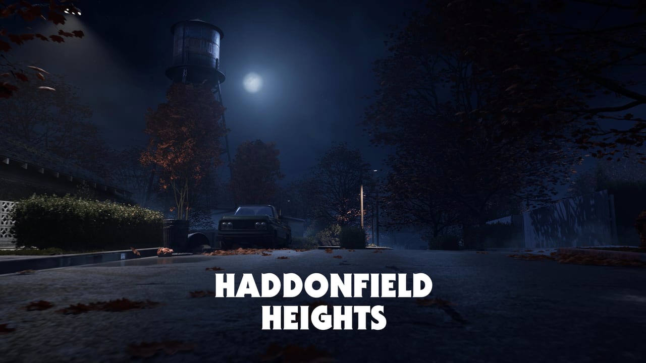
Heights is the neighborhood people already think they know. Modest single-family homes, front yards, hedges, and winding side streets sit under an enormous water tower. Halloween night in 1963 still hangs over the block. Fifteen years later, the nightmare is back.
Landmarks:
- The Strode house, the family-friendly address the film burned into memory.
- The abandoned Myers house on the way toward Lampkin Lane.
- Lampkin Lane itself, the street people gather at the water tower to tell stories about.
This is the intimate panic map. Hedges and hallways matter. Shape Jump through a fence is more common than a mill chase. Civilians can actually see a porch light from the next yard, which is both safety and a tell. If you learned the franchise from the 1978 film, start here so the first match feels like the movie before Orange Grove asks you to climb stairs.
Orange Grove Estates
Orange Grove is the upscale corner. Multi-story homes with detached garages and balconies surround a playground and basketball court. Yards are wide. Fences and hedges are still cover, but lines of sight are longer than Heights, and upper floors create vertical fights.
Landmarks:
- The Wallace residence, where Annie Brackett babysits, including the backyard shed and room-to-room pathing the studio rebuilt from the film.
- The Doyle house across the street, Laurie Strode’s babysitting job, with signature rooms fans will recognize.
Open lawns punish civilians who sprint without a lamp plan and punish Myers who exits Shape Jump in the middle of a lit yard. Balconies and stairwells are where Detection Pulse and Shape Slip earn their keep. If your controls camera never looks up, you will miss someone on a second floor.
Haddonfield Town Center
Town Center is the cultural and economic hub, the place residents shop, drink, and solve household problems until the hardware store becomes a crime scene. Nichols Hardware sits at the heart of the map and is the film beat where Myers completes the Boogeyman look. Official copy ties that shop to the costume. The rest of downtown is the expanded Midwest street around it.
Landmarks:
- Nichols Hardware
- A-Side Music
- Hill Garden Center
- Patty’s Pub
- Maggie’s Auto
- the post office
- the cemetery
Expect shop floors, back rooms, alley connects, and a graveyard that does not play like a suburban hallway. Civilians can lose a neighbor inside a store. Myers can cut a phone in a civic building and be gone before the next customer looks up. This is the map that sells Haddonfield as a town instead of a subdivision.
How to study them before September 8
You do not need a callout sheet for every hedge. You need four silhouettes: mill and biker bar, water tower and Lampkin Lane, Doyle and Wallace across a playground, downtown hardware and cemetery. Play Story Mode to walk film-inspired streets without a queue. Confirm the system requirements if you are on PC so the first mill or hardware store is not a 20 fps slideshow. Then, in 1v4, pick a landmark as a meeting point instead of pinging an unnamed lawn.
Four maps is a full town. Heights is the memory. Orange Grove is the babysitting block. Town Center is the errand run. East Haddonfield is the road in. Learn those names before the first blackout, and the rest of the wiki can talk about stalk and police calls without you asking which porch anyone meant.
Frequently Asked Questions
Quick answers to the most common questions.
How many maps launch with the game?
Four: East Haddonfield, Haddonfield Heights, Orange Grove Estates, and Haddonfield Town Center. All are scheduled to be in the September 8, 2026 digital launch.
Which map has the Myers house and Lampkin Lane?
Haddonfield Heights. It also includes the Strode house and the water tower.
Where are the Doyle and Wallace homes?
Orange Grove Estates. They sit in an upscale multi-story neighborhood with a playground and long yards.
Which map has Nichols Hardware?
Haddonfield Town Center, along with A-Side Music, Hill Garden Center, Patty's Pub, Maggie's Auto, the post office, and the cemetery.
Is East Haddonfield from the films?
It expands the town beyond the famous suburb. Official landmarks include the Rabbit in Red Lounge, Phelps Garage, Midwest Feed, and Castle Hill Rooks territory around a rural mill.
Do objectives change by map?
The 1v4 rules stay the same: Myers hunts, civilians warn NPCs and call police. Maps change sightlines, interiors, and which landmarks you use as rally points.